Satellite data on snow cover
Snow cover is observed by different techniques, therefore there are many sources of data. Each of them has its advantages and disadvantages. For the purposes of this site, we used the data of the Interactive Multisensor Snow and Ice Mapping System (IMS) project1. The data are available at no cost from NOAA servers.
If you have the appropriate knowledge in the field of climatology and satellite remote sensing, also a technical skills in the field of Geographic Information System (GIS), and a plenty of time, you will probably be able to analyse IMS data on your own. Otherwise, you may want to consider help from our side.
The version of IMS data used by us have already been pre-processed, including conversion to a standard GIS format of GeoTIFF, and verified for the temporal homogeneity. We use data of different spatial resolution - from 24 km/pixel (data starting 1997), to 4 km/pixel (data starting 2004). The spatial resolution is too coarse to assess the snow conditions on the ski slopes, but fine enough to determine the conditions along the major communication routes, or climate conditions within the provinces, districts, and municipalities.
|
|
|
|
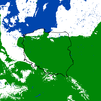
Fig. 1. Example IMS data for Poland - 24 km/pixel, available since 1997 (used for analyses by CBK PAN) |
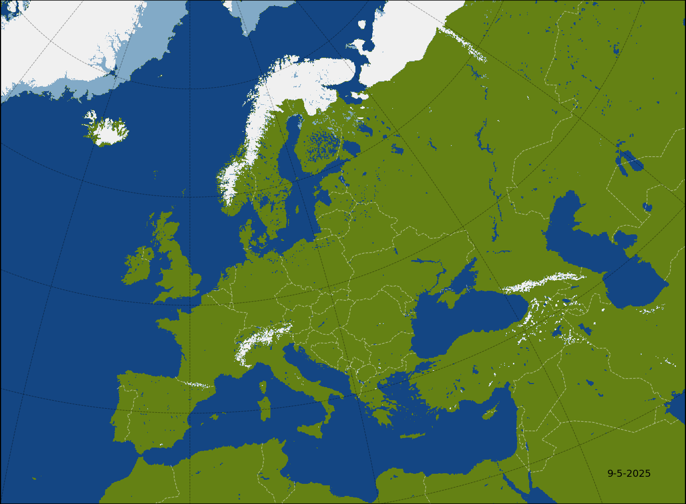
Fig. 2. Example IMS data for Poland - 4 km/pixel, available since 2004 (featured on this page) |

CBK PAN also has the experience with other satellites and instruments, including: MODIS, SEVIRI, VIIRS, Landsat and Sentinel satellites of the European Copernicus Programme. On the basis of those data, we can develop scientific publications, as well as business and legal expertises for the purposes of the public administration and business.All interested in cooperation (both scientific and business), please contact: zoz@cbk.waw.pl.
Snow is not only our specialty. Visit the website of Earth Observation Department, CBK PAN to learn more about our experience.
Map with the current extent of snow cover.
Every day, we automatically update the map of the extent of snow cover in Europe and the snow chart of the current winter. These are available at the indicated url's:
- Snow cover extent map - http://zoz.cbk.waw.pl/images/stories/snow/mapa_duza.png
- Chart for the current winter - http://zoz.cbk.waw.pl/images/stories/snow/wykres_pl-pl.pdf
If you use our results or information from this service somewhere, please let us know (at zoz@cbk.waw.pl). We would greatly appreciate it.
1U.S. National Ice Center. (2004). IMS Daily Northern Hemisphere Snow and Ice Analysis at 1 km, 4 km, and 24 km Resolutions, Version 1. NSIDC. https://doi.org/10.7265/N52R3PMC